
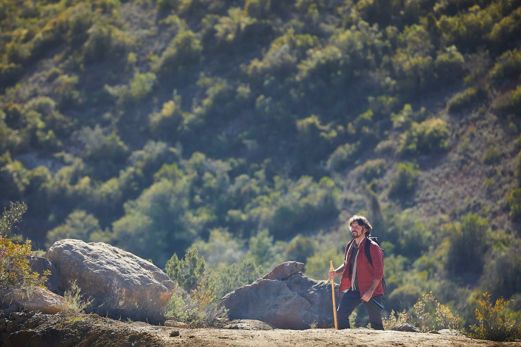
Hiker walking in the Algarvensis Geopark ©Geopark Algarvensis
Most visitors come to the Algarve chasing golden beaches, yet some of the region’s biggest surprises are hidden down narrow country lanes, coastal boardwalks, and mountain ridges.
Having your own set of wheels turns this compact region, stretching from the Atlantic Ocean in the west to the Guadiana River in the east, into an open-air playground. You can drive straight to remote trailheads for a morning hike and still make it back to the coast for a fresh seafood lunch.
Why the Algarve is a hiker’s paradise
Nearly 38% of the Algarve falls under environmental protection, encompassing three Natural Parks (Ria Formosa, Southwest Alentejo and Vicentine Coast, and the Castro Marim and Vila Real de Santo António Marshlands), Protected Landscapes, and 14 Natura 2000 sites.
Depending on which direction you point your car, you can explore five distinct geographical zones:
Costa Vicentina (West Coast): Dramatic black schist cliffs, wild beaches, suspended coastal dunes, and rare endemic flora.
Litoral Sul (South Coast): Golden limestone karst formations, sea stacks, hidden coves, and rich coastal lagoons teeming with birdlife.
Barrocal (Central Limestone Belt): The transitional heartland of traditional dryland orchards (carob, almond, fig, and olive trees), whitewashed villages, and Moorish hydraulic heritage.
Serra (Mountain Ranges): Lush cork oak and chestnut forests, cascading waterfalls, and panoramic peaks in the Monchique, Caldeirão, and Espinhaço de Cão mountains.
Guadiana (Eastern Border): Peaceful rolling hills, traditional schist hamlets, ancient mines, and historic smuggling trails overlooking Spain.
Choosing the right season for your hike
With a mild Mediterranean climate and over 300 sunny days annually, the Algarve is a true year-round hiking destination:
Best overall (Spring and Autumn): From March to May and September to November, daytime temperatures are mild and comfortable, making these the prime months for both mountain climbs and coastal treks.
Best for waterfalls and blossoms (Winter): Between December and February, sunny spells follow brief rain showers—the only time you’ll see Monchique’s seasonal cascades in full flow and almond orchards blanketed in white flowers.
Best for early-morning coastal walks (Summer): From June to August, inland valleys regularly exceed 30°C–40°C, so stick to breezy Atlantic clifftop trails and Ria Formosa boardwalks before midday.
1. Costa Vicentina trails
Cerros da Carrapateira
Municipality: Aljezur
Distance: 13.2 km
Trail Type: Circular
Difficulty: Moderate (400 m elevation gain along dirt tracks and undulating hills)
Highlights: Part of the Rota Vicentina, this scenic loop winds through rolling hills, valleys, and cork oak ravines, offering sweeping panoramic views over Amado Beach, the Carrapateira dunes, Vilarinha village, and the Monchique mountains.
Da Bordeira até ao Mar (From Bordeira to the Sea)
Municipality: Aljezur
Distance: 13.5 km (with a 6 km shorter alternative)
Trail Type: Circular
Difficulty: Moderate (325 m elevation gain with sandy stretches)
Highlights: Starting in the traditional village of Bordeira, this route crosses the ancient Bordalete stone pine forest and traverses suspended dunes atop dramatic coastal cliffs rich in rare Vicentine plant species.
Endiabrada e os Lagos Escondidos (Endiabrada and the Hidden Lakes)
Municipality: Aljezur
Distance: 16 km (with a 7 km shorter alternative)
Trail Type: Circular
Difficulty: Challenging (415 m elevation gain over 16 km of dirt tracks)
Highlights: Exploring the lush interior behind Bordeira, hikers walk through dense native cork oak forests, ferns, and shaded valleys concealing two tranquil freshwater dam lakes.
Circuito Cultural e Ambiental de Aljezur (Aljezur Cultural and Environmental Circuit)
Municipality: Aljezur
Distance: 6.4 km
Trail Type: Circular
Difficulty: Easy to Moderate (200 m elevation gain on paved, cobbled, and dirt paths)
Highlights: A rich blend of history and nature that climbs to the 10th-century Moorish Castle of Aljezur before following the fertile river valley and riverside alder galleries once navigated by 16th-century trading ships.
Trilho Ambiental do Castelejo (Castelejo Environmental Trail)
Municipality: Vila do Bispo
Distance: 3.5 km
Trail Type: Circular
Difficulty: Easy (110 m elevation gain)
Highlights: Starting from the Castelejo picnic area, this short woodland walk loops through coastal stone pines and aromatic scrubland, offering views toward Torre de Aspa—the highest coastal cliff point in the Algarve at 156 meters.
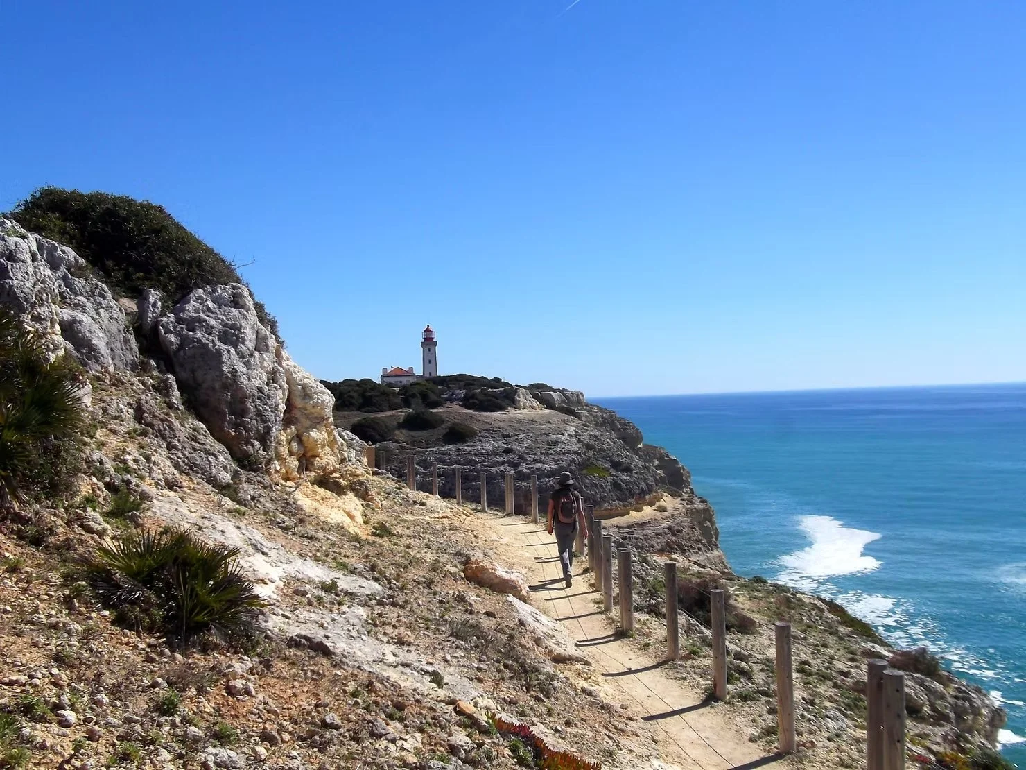
Hiker walking along the clifftop path of the Seven Hanging Valleys Trail toward the Alfanzina Lighthouse ©Quimera Travel Experiences
2. Litoral Sul (South Coast) Trails
A Rocha Delicada
Municipality: Portimão
Distance: 6.5 km
Trail Type: Circular
Difficulty: Easy (80 m elevation gain on flat dirt tracks)
Highlights: Located on the Quinta da Rocha peninsula in the Alvor Estuary, this peaceful route passes traditional orchards, salt marshes, and fossil-rich limestone cliffs ideal for spotting flamingos, spoonbills, and wading birds.
Ao Sabor da Maré (At the Mercy of the Tide)
Municipality: Portimão
Distance: 4.8 km
Trail Type: Circular
Difficulty: Easy (30 m elevation gain along wooden boardwalks, dirt, and sand)
Highlights: Following the western sandspit of the Ria de Alvor, this accessible boardwalk and dune walk showcases local shellfish gatherers at low tide and nesting coastal birds like the little tern.
Caminho dos Promontórios (Path of the Headlands)
Municipality: Lagoa
Distance: 6 km one-way (12 km round trip)
Trail Type: Linear
Difficulty: Moderate (340–365 m elevation gain over rocky, uneven clifftop paths)
Highlights: Hugging the dramatic coastline between Praia do Molhe and Carvoeiro, this trail passes the 17th-century Torre da Lapa watchtower, Roman fish-salting ruins, and Leixão da Gaivota, Portugal’s smallest Special Protection Area for nesting herons.
Percurso dos Sete Vales Suspensos (Seven Hanging Valleys Trail)
Municipality: Lagoa
Distance: 6 km one-way (12 km round trip)
Trail Type: Linear
Difficulty: Moderate (360–370 m elevation gain with frequent ups and downs along rocky cliffs)
Highlights: Arguably the Algarve’s most iconic coastal hike, connecting Praia da Marinha to Praia de Vale Centeanes. Expect breathtaking sea arches, sinkholes, the famous Benagil coastline, Alfanzina Lighthouse, and hidden coves.
Percurso de Interpretação da Praia Grande (Praia Grande Interpretation Trail)
Municipality: Silves
Distance: 5.2 km
Trail Type: Linear
Difficulty: Easy (60 m elevation gain across boardwalks, sand, and dirt paths)
Highlights: Bordering the Salgados Lagoon—an internationally recognized Important Bird Area—this route winds through coastal dunes, fossilized cliffs rich in marine shells, and wetlands frequented by large flocks of flamingos.
Trilho de São Lourenço (São Lourenço Trail)
Municipality: Loulé
Distance: 3.3 km (round trip)
Trail Type: Linear
Difficulty: Easy (55 m elevation gain on flat dirt paths)
Highlights: Nestled inside the Ria Formosa Natural Park in Quinta do Lago, this trail skirts freshwater lakes with birdwatching hides—perfect for spotting the rare purple swamphen (the park's symbol)—and passes ancient Roman fish-salting tanks (cetárias).
Percursos do Ludo (Ludo Trails)
Municipalities: Faro and Loulé
Distance: 8.4 km
Trail Type: Linear
Difficulty: Easy (40–70 m elevation gain on flat dirt tracks)
Highlights: Located right next to Faro Airport, this serene walk bridges coastal stone pine woods and the Ria Formosa saltpans, where glistening mounds of "white gold" (sea salt) attract hundreds of flamingos and waders.
Ilha da Culatra (Culatra Island Trail)
Municipality: Faro
Distance: 5.6 km (round trip)
Trail Type: Linear
Difficulty: Easy (20 m elevation gain on wooden boardwalks and beach sand)
Highlights: Accessible by ferry from Olhão, this island walk takes you from a traditional 19th-century fishing community across pristine barrier-island dunes via boardwalks to a viewpoint overlooking rich shellfish beds and pristine Atlantic beaches.
Percurso Pedestre do Centro de Educação Ambiental de Marim (Marim Environmental Education Centre Trail)
Municipality: Olhão
Distance: 3.5 km
Trail Type: Circular
Difficulty: Easy (50 m elevation gain)
Highlights: Located at the headquarters of the Ria Formosa Natural Park (Quinta de Marim), this educational loop passes through umbrella pine woods, freshwater ponds, bird hides, a wildlife recovery center, and a historic tidal mill that operated until 1970.
Trilho da Praia do Barril (Barril Beach Trail)
Municipality: Tavira
Distance: 3 km (round trip)
Trail Type: Linear
Difficulty: Easy (20 m elevation gain on paved paths, boardwalks, and sand)
Highlights: Crossing the Tavira channel from Pedras d'El Rei onto Tavira Island, this flat walk crosses salt marshes teeming with fiddler crabs before reaching Barril Beach, famous for its poignant "Anchor Cemetery" commemorating the region's historic tuna-fishing fleet.
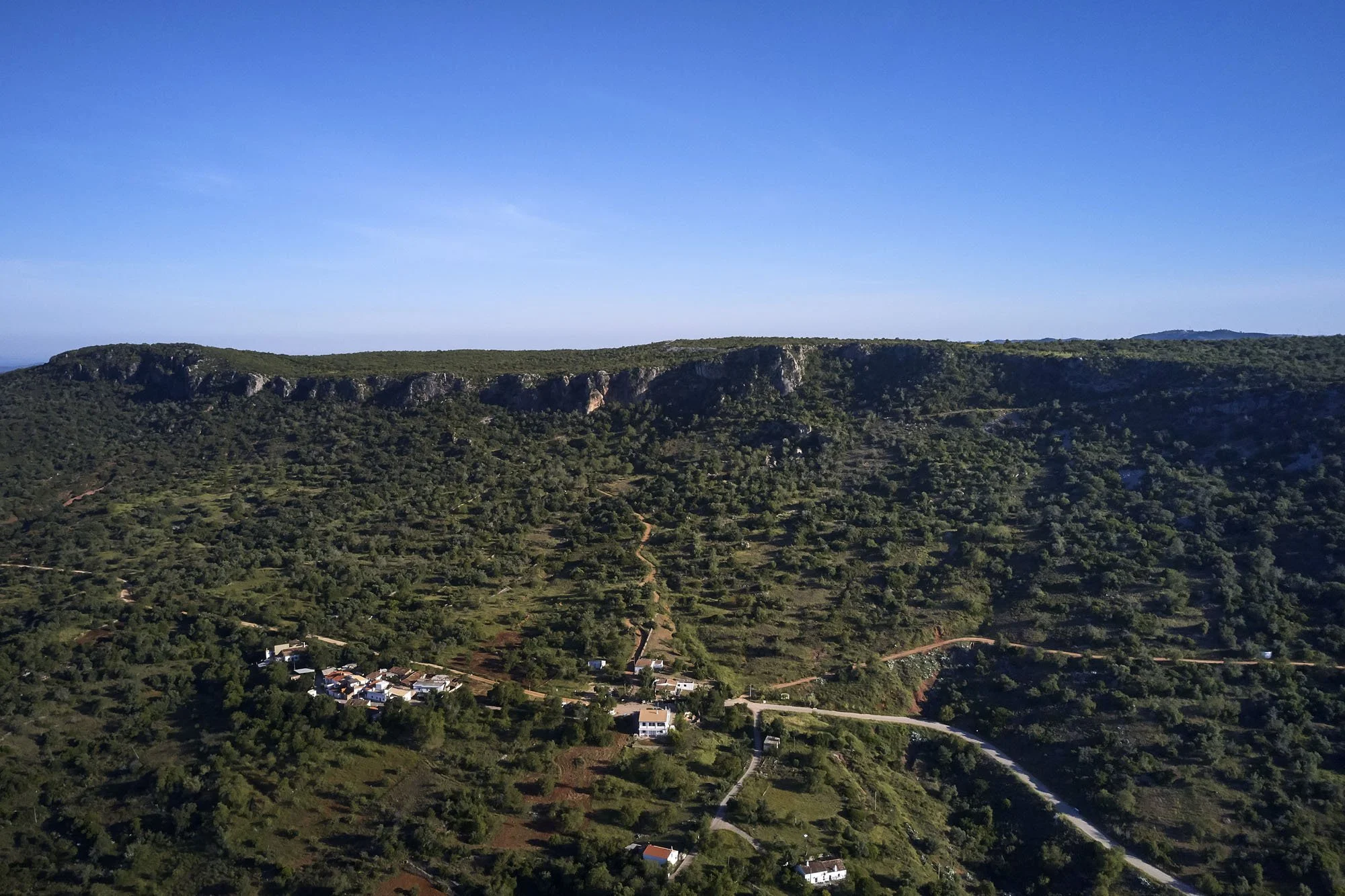
Aerial view of the Rocha da Pena limestone escarpment, in the Algarve. ©Geoparque Algarvenis
3. Barrocal Trails
Percurso do Parque Municipal do Sítio das Fontes (Sítio das Fontes Municipal Park Trail)
Municipality: Lagoa
Distance: 1.3 km
Trail Type: Circular
Difficulty: Easy (30 m elevation gain)
Highlights: A short, family-friendly nature trail along a creek of the Arade River featuring natural freshwater springs from the Querença-Silves aquifer, a restored watermill, a traditional nora (waterwheel), and picnic facilities.
Percurso do Castelo de Paderne (Paderne Castle Trail)
Municipality: Albufeira
Distance: 3.2 km
Trail Type: Circular
Difficulty: Easy (117 m elevation gain on dirt and stony tracks)
Highlights: Just minutes inland from Albufeira’s beaches, this loop winds along the lush Quarteira stream, passing an ancient medieval stone bridge, watermill ruins, and climbing up to the striking 12th-century Almohad rammed-earth castle.
Percurso da Rocha da Pena (Rocha da Pena Trail)
Municipality: Loulé
Distance: 6.4 km
Trail Type: Circular
Difficulty: Moderate (275 m elevation gain on rocky limestone terrain)
Highlights: Ascending a monumental limestone plateau rising to 479 meters, this protected landscape offers sweeping views from the mountains to the sea, Iron Age defensive walls, the bat-inhabited Algar dos Mouros cave, and soaring birds of prey like Bonelli’s eagle.
Percurso da Tôr (Tôr Trail)
Municipality: Loulé
Distance: 5.2 km
Trail Type: Circular
Difficulty: Easy (112 m elevation gain)
Highlights: Starting in the picturesque whitewashed village of Tôr, this rural walk crosses a medieval bridge built over Roman foundations, winds through carob and olive groves, and fords the Algibre stream where otters and kingfishers thrive.
Percurso da Fonte da Benémola (Fonte da Benémola Trail)
Municipality: Loulé
Distance: 4.1 km
Trail Type: Circular
Difficulty: Easy (154 m elevation gain on dirt tracks)
Highlights: A shaded, refreshing oasis between Querença and Tôr fed by perennial springs, showcasing Moorish-inspired irrigation channels (levadas), watermills, traditional lime kilns, and lush riverside vegetation.
Caminhos e Encruzilhadas de ir à Fonte (Paths and Crossroads to the Spring)
Municipality: São Brás de Alportel
Distance: 8.4 km
Trail Type: Circular
Difficulty: Moderate (310 m elevation gain on rural and paved tracks)
Highlights: Tracing centuries-old dry-stone walled paths through the Bengado Valley, this route bridges the limestone Barrocal and schist mountains, passing Roman road sections, traditional terracotta tile workshops, and a fossil-rich quarry geopoint.
4. Serra (Mountain) Trails
Percurso da Pedra do Galo (Pedra do Galo Trail)
Municipality: Lagos
Distance: 6.3 km
Trail Type: Circular (with a 1 km linear section)
Difficulty: Easy to Moderate (177 m elevation gain on forest dirt roads)
Highlights: Immersed in the Barão de São João National Forest in the Espinhaço de Cão hills, this shaded woodland walk leads through pine, cork oak, and strawberry trees to a Neolithic limestone menhir with views toward Monchique.
Trilho das Cascatas (Waterfalls Trail)
Municipality: Monchique
Distance: 17.6 km
Trail Type: Circular (with a 1.5 km linear section)
Difficulty: Challenging (787 m elevation gain over 17.6 km)
Highlights: Starting near Fóia, this demanding mountain trek explores Monchique’s unique humid microclimate, visiting the Penedo do Buraco, Chilrão, and Barbelote waterfalls amid terraced hillsides, chestnut groves, and rare Monchique oaks.
Trilho da Fóia (Fóia Trail)
Municipality: Monchique
Distance: 6.9 km
Trail Type: Circular
Difficulty: Moderate (355 m elevation gain)
Highlights: Beginning at the highest point in the Algarve (902 meters), this high-altitude loop offers jaw-dropping views from the West Coast to the South Coast while passing syenite boulder fields, terraced orchards, and rare Rhododendron (adelfeira) relics.
Trilho dos Moinhos (Watermills Trail)
Municipality: Monchique
Distance: 9.4 km
Trail Type: Circular
Difficulty: Moderate (485 m elevation gain)
Highlights: Looping north from Monchique town, this trail passes monumental 150-year-old trees, follows the rushing waters of Barranco dos Pisões to the historic Poucochinho watermill, traverses a rare native holly forest, and visits the 17th-century Convent of Nossa Senhora do Desterro.
Percurso do Lagoão (Lagoão Trail)
Municipality: Silves
Distance: 8 km
Trail Type: Circular
Difficulty: Easy to Moderate (182 m elevation gain)
Highlights: Circling the mountain village of São Marcos da Serra along the Odelouca River, this pastoral route weaves through cork oak montados, citrus orchards, and fertile floodplains, finishing near the parish church and its iconic 17th-century Algarve chimney.
Circuito Arqueológico da Vilarinha – Vale Fuzeiros (Vilarinha – Vale Fuzeiros Archaeological Circuit)
Municipality: Silves
Distance: 6 km
Trail Type: Circular
Difficulty: Moderate (245 m elevation gain)
Highlights: A fascinating journey through time across striking red Triassic sandstone formations (Grés de Silves), featuring a 6,000-year-old alignment of four Neolithic menhirs and three Visigothic rock-cut necropolises.
Percurso Pedestre Ameixial (Ameixial Walking Trail)
Municipality: Loulé
Distance: 4.5 km
Trail Type: Circular
Difficulty: Easy to Moderate (192 m elevation gain)
Highlights: Located in the Serra do Caldeirão, this village walk celebrates the ancient "Southwest Script" (the Iberian Peninsula's oldest known writing) through public art installations, traditional schist houses, and the iron-rich Fonte da Seiceira spring.
Percurso Pedestre Revezes (Revezes Walking Trail)
Municipality: Loulé
Distance: 13 km
Trail Type: Circular
Difficulty: Moderate to Challenging (468 m elevation gain)
Highlights: Venturing to the remote northern border along the Vascãozinho and Vascão rivers (which separate the Algarve from Alentejo), this tranquil hike traverses cork forests, white stork nesting grounds, and otter habitats.
Trilho da Ribeira de Alportel (Alportel Stream Trail)
Municipality: São Brás de Alportel
Distance: 12.3 km
Trail Type: Circular
Difficulty: Moderate (378 m elevation gain)
Highlights: Following ancient muleteer trade paths (caminhos de almocreves), this trail showcases cork-harvesting forests, historic communal washbasins, panoramic viewpoints, and the Alportel Biodiversity Station, home to rare dragonflies and river turtles.
Passeio Ornitológico O Ninho ("The Nest" Birdwatching Walk)
Municipality: São Brás de Alportel
Distance: 2.5 km
Trail Type: Circular
Difficulty: Easy (113 m elevation gain)
Highlights: A short, themed walk around the hamlet of Javali organized around six informative panels dedicated to local bird species, including the blue rock thrush, golden oriole, Bonelli’s eagle, and goldfinch.
Barranco das Lajes (Lajes Ravine Trail)
Municipality: São Brás de Alportel
Distance: 5.4 km
Trail Type: Circular
Difficulty: Moderate (240 m elevation gain)
Highlights: Descending from the mountain hamlets of Cabanas and Lajes into a dramatic schist and greywacke gorge, this loop climbs natural rock steps up to Cerro da Ursa for sweeping views across the Caldeirão hills.
Percurso da Reserva (Reserva Trail)
Municipality: Tavira
Distance: 5.9 km
Trail Type: Circular
Difficulty: Moderate (285 m elevation gain)
Highlights: Starting at the Feiteira Discovery Centre in the hills of Cachopo, this rural loop winds past schist ruins, stacks of harvested cork, the Leitejo stream, and the ridge of Cerro da Eira da Capa.
Percurso da Masmorra (Masmorra Trail)
Municipality: Tavira
Distance: 5.8 km
Trail Type: Circular
Difficulty: Moderate (400 m elevation gain)
Highlights: Exploring the remote village of Mealha, walkers can admire traditional circular thatched schist barns (palheiros), cross clear mountain streams on stepping stones, and visit the hilltop Anta da Masmorra, a late-Neolithic megalithic tomb.
Percurso dos Montes Serranos (Mountain Hamlets Trail)
Municipality: Tavira
Distance: 9.1 km
Trail Type: Circular
Difficulty: Moderate (334 m elevation gain)
Highlights: Linking the traditional schist hamlets of Casas Baixas, Alcarias Baixas, and Amoreira, this route shares a section with the Via Algarviana and contrasts ancient windmills with modern wind turbines along high mountain ridges.
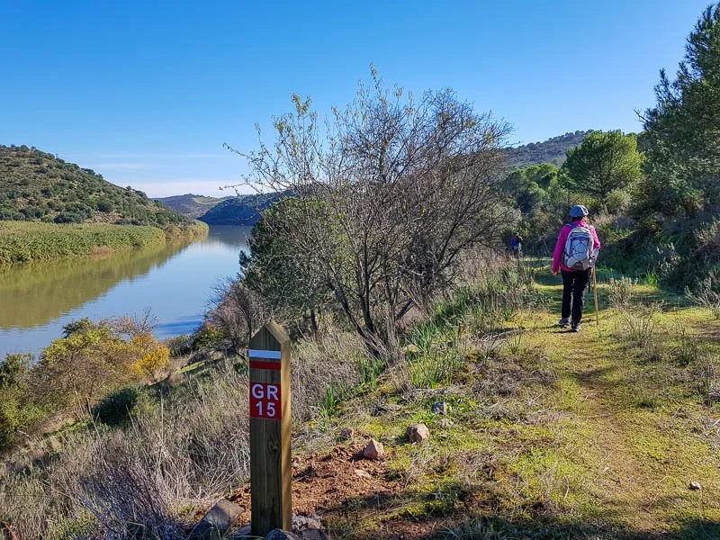
Hiker walking along a grassy riverside trail beside the Guadiana River marked with a GR15 Grande Rota do Guadiana signpost in eastern Algarve. ©VagaMundos
5. Guadiana (Eastern Algarve) Trails
Memória Viva (Living Memory)
Municipality: Alcoutim
Distance: 14 km (with a 10 km shorter option)
Trail Type: Circular
Difficulty: Moderate (335 m elevation gain)
Highlights: Starting in Martim Longo, this trail offers an authentic glimpse into rural Lower Guadiana life, passing traditional stone-walled farmsteads, communal bread ovens, bee-keeping areas, and abandoned schist hamlets.
Cerro acima, cerro abaixo (Up Hill, Down Dale)
Municipality: Alcoutim
Distance: 12.8 km
Trail Type: Circular
Difficulty: Moderate to Challenging (477 m elevation gain)
Highlights: True to its name, this undulating hike around Vaqueiros crosses the rocky Foupana and Foupanilha streams and visits the Cova dos Mouros copper mine, which was worked from the Chalcolithic era through Roman times.
Caminho da Amendoeira (Almond Tree Path)
Municipality: Castro Marim
Distance: 11.2 km
Trail Type: Circular
Difficulty: Moderate to Challenging (495 m elevation gain)
Highlights: Beginning in Alta Mora, this scenic route winds through centuries-old dryland orchards—spectacular in January and February when the almond trees bloom white—and descends to the Beliche stream.
Caminhos da Fonte (Paths of the Spring)
Municipality: Alcoutim
Distance: 10 km
Trail Type: Circular
Difficulty: Moderate (260 m elevation gain)
Highlights: Starting at the Blacksmith’s Museum in Pereiro, this loop traverses rolling holm oak hills, passes the deserted 18th-century hamlet of Silveira, and skirts the Pereiro irrigation dam where Mediterranean turtles and herons gather.
Boa Vista
Municipality: Vila Real de Santo António
Distance: 10 km
Trail Type: Circular
Difficulty: Moderate (260 m elevation gain)
Highlights: Departing from Corte António Martins, this route climbs to the Boa Vista ridge, rewarding hikers with sweeping coastal vistas stretching from Cacela Velha all the way across the border to Isla Canela in Spain.
Circuito do Beliche (Beliche Circuit)
Municipality: Castro Marim
Distance: 6.2 km
Trail Type: Circular
Difficulty: Easy to Moderate (180 m elevation gain)
Highlights: Starting on the dam wall of the Beliche Reservoir, this pleasant loop circles the northern hills and lush agricultural valley, passing a well-preserved traditional waterwheel (nora) and citrus orchards.
Ladeiras do Pontal (Slopes of Pontal)
Municipality: Alcoutim
Distance: 13.3 km
Trail Type: Circular
Difficulty: Moderate to Challenging (440 m elevation gain)
Highlights: Overlooking a dramatic bend in the Guadiana River toward Sanlúcar Castle in Spain, this trail follows old smuggling routes (Rota do Contrabandista) through century-old olive groves and past former border guard posts.
Terras da Ordem (Lands of the Order)
Municipality: Castro Marim
Distance: 12 km
Trail Type: Circular
Difficulty: Moderate (380 m elevation gain)
Highlights: Exploring the Terras da Ordem National Forest—owned by religious orders until the 19th century—this loop follows the confluence of the Foupana and Odeleite rivers and visits the restored Pernadas watermill.
Os Encantos de Alcoutim (The Charms of Alcoutim)
Municipality: Alcoutim
Distance: 4.6 km
Trail Type: Circular
Difficulty: Easy (166 m elevation gain)
Highlights: A captivating cultural and riverside walk around the border town of Alcoutim, taking in the 14th-century castle, the Islamic-era Castelo Velho ruins, the Smuggler’s Statue on the riverfront, and the Pego Fundo river beach.
Uma Janela para o Guadiana (A Window onto the Guadiana)
Municipality: Castro Marim
Distance: 7.4 km
Trail Type: Circular
Difficulty: Moderate (225 m elevation gain)
Highlights: Setting out from the traditional village of Azinhal, this trail passes an old windmill and stone sheepfolds before opening onto wide panoramic views of the Guadiana estuary and the International Bridge to Spain.
Sapal de Venta Moinhos (Venta Moinhos Salt Marsh)
Municipality: Castro Marim
Distance: 7 km (round trip)
Trail Type: Linear
Difficulty: Easy (50 m elevation gain on flat dirt tracks)
Highlights: Located inside Portugal’s first Nature Reserve, this flat wetland trail weaves between carob orchards, traditional saltpans, and tidal marshes where roughly 170 bird species—including black-winged stilts, flamingos, and storks—can be spotted.
Passeio Pombalino (Pombaline Walk)
Municipality: Vila Real de Santo António
Distance: 2 km
Trail Type: Circular
Difficulty: Easy (25 m elevation gain on cobbled town streets)
Highlights: An urban heritage stroll through the grid-patterned 18th-century center of Vila Real de Santo António, built from scratch after the 1755 earthquake under the Marquis of Pombal, showcasing the riverfront promenade and historic canning industry landmarks.
6. Long-distance trails
For dedicated hikers looking to tackle multi-day adventures, or simply pick a single day-stage using your rental car, four major long-distance trails cross the region:
Via Algarviana (GR13)
Municipalities: Alcoutim, Castro Marim, Tavira, São Brás de Alportel, Loulé, Silves, Monchique, Portimão, Lagos, Aljezur, and Vila do Bispo (11 municipalities)
Distance: 300 km (divided into 14 stages of 14.3 to 30.2 km each)
Trail Type: Linear
Difficulty: Challenging (Multi-day trek reaching 850 m near Fóia; individual stages range from Moderate to Challenging)
Highlights: Crossing the entire inland Algarve from Alcoutim on the Spanish border to Cape St. Vincent in Sagres, traversing the Serra do Caldeirão, Barrocal, and Serra de Monchique.
Rota Vicentina – Historical Way (GR11)
Municipalities: Aljezur and Vila do Bispo (in the Algarve, continuing north into Alentejo through Odemira, Sines, and Santiago do Cacém)
Distance: 230 km total (divided into 12 stages of 12 to 25 km each)
Trail Type: Linear
Difficulty: Moderate to challenging (multi-day rural and coastal trail)
Highlights: Following ancient pilgrim and rural paths through cork forests, valleys, and coastal villages down to Cape St. Vincent, complemented by the dramatic cliff-hugging Fishermen’s Trail.
Grande Rota do Guadiana (GR15)
Municipalities: Vila Real de Santo António, Castro Marim, and Alcoutim
Distance: 65 km (typically walked in 3 days)
Trail Type: Linear
Difficulty: Moderate to challenging
Highlights: Linking the coastal river mouth at Vila Real de Santo António to the historic border town of Alcoutim, passing salt marshes, riverside fishing hamlets, and rolling schist hills.
Percurso Descoberta (GR23)
Municipality: Tavira
Distance: 45 km (divided into 3 stages of 12 km, 16 km, and 17 km)
Trail Type: Circular
Difficulty: Moderate to Challenging
Highlights: A circular mountain route in the heart of the Serra do Caldeirão connecting the rural hamlets of Casas Baixas, Feiteira, and Mealha, where walkers can stay overnight in restored primary schools converted into Rural Discovery Centres.
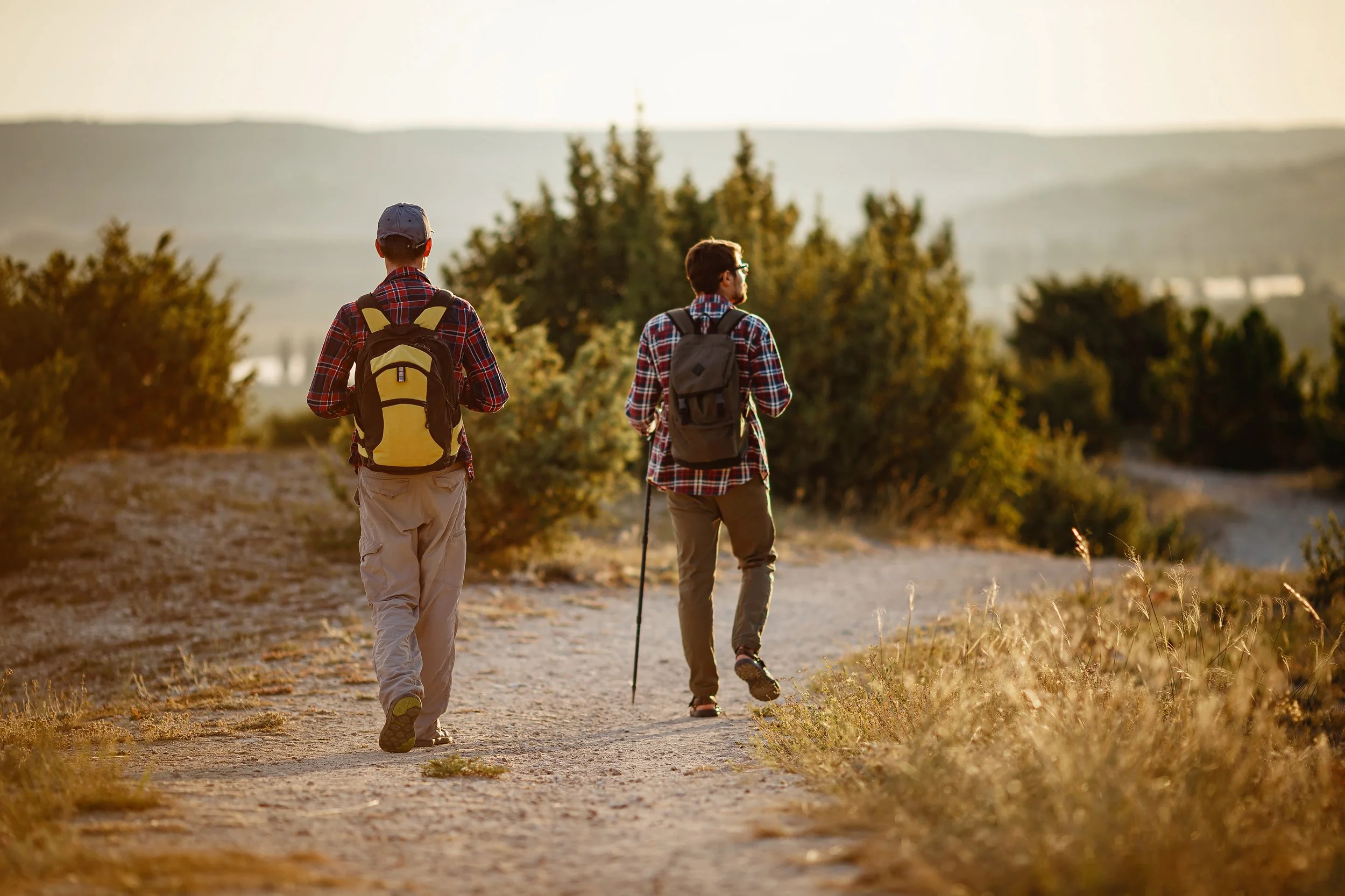
Two hikers with backpacks walking along a rural dirt trail.
Essential tips before you hit the trail
Drive smart, park safely: Never park on the edge of coastal cliffs (many limestone cliffs are unstable) or drive onto sand dunes. Use designated parking areas at trailheads and villages.
Pack for the microclimate: Even on sunny coastal days, mountain areas like Monchique can be cool and misty, while inland valleys get hot. Bring layers, sturdy footwear, sun protection, plenty of water, and snacks.
Respect rural and protected areas: Stick to marked trails (red-and-yellow blazes for Short Routes / PR; white-and-red blazes for Long-Distance Routes / GR), carry all trash back to your car, and be mindful of hunting zones on Thursdays, weekends, and holidays during autumn and winter.
